Camp Bullis Sentinel Landscape
-
Texas
-
Established 2022
About
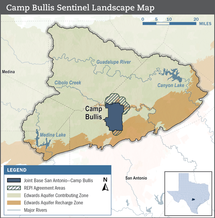
The Camp Bullis Sentinel Landscape encompasses ranchlands, growing towns and cities, and spring-fed rivers within the Texas Hill Country. The landscape is anchored by Joint Base San Antonio-Camp Bullis, which provides training opportunities for 266 mission partners. This installation supports all Department of War medic field training, military intelligence, special forces, pre-deployment, and other national and international defense operations.
With rapid population growth emanating from San Antonio and the I-35 corridor, the Camp Bullis Sentinel Landscape faces mounting challenges to the long-term resilience of the region’s natural resources and military infrastructure. Incompatible development contributes to the loss of agricultural lands and increased ambient light pollution, disrupting night-time military training. Camp Bullis, situated in Flash Flood Alley, also faces flooding issues from an increase in impervious surfaces around the base. Growing demands on existing water supplies have led to the loss of spring flow and aquifer drawdowns, affecting water availability for Camp Bullis, rural landowners, and local population centers.
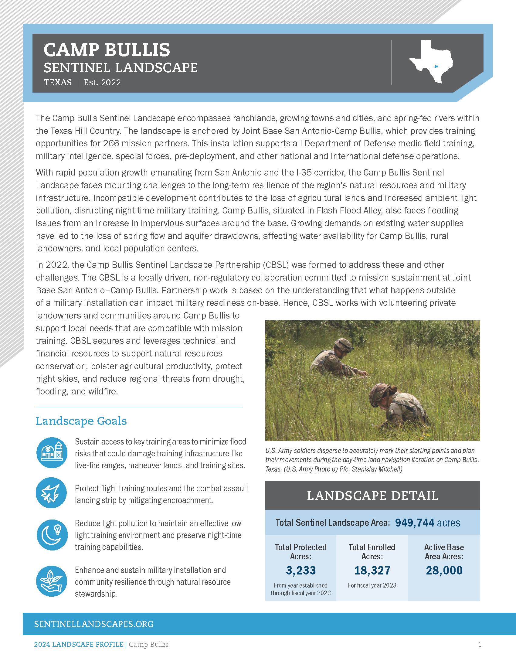
In 2022, the Camp Bullis Sentinel Landscape Partnership (CBSL) was formed to address these and other challenges. The CBSL is a locally driven, non-regulatory collaboration committed to mission sustainment at Joint Base San Antonio–Camp Bullis. Partnership work is based on the understanding that what happens outside of a military installation can impact military readiness on-base. Hence, CBSL works with volunteering private landowners and communities around Camp Bullis to support local needs that are compatible with mission training. CBSL secures and leverages technical and financial resources to support natural resources conservation, bolster agricultural productivity, protect night skies, and reduce regional threats from drought, flooding, and wildfire.
Total Funding by Partner
| Partner | FY2022 | FY2023 |
|---|---|---|
| USDA | $0.00M | $0.33M |
| DOW | $0.00M | $0.00M |
| DOI | $0.00M | $12.50M |
| State | $1.58M | $5.01M |
| Local | $2.91M | $3.50M |
| Private | $0.17M | $11.20M |
| DoD | $2.00M | $6.32M |
Total Acres Protected and Enrolled
| Acres Protected (Since Designation) | 3233 |
|---|---|
| Acres Enrolled (During FY23) | 18327 |
Our Partners
Federal Partners
- Camp Stanley
- Federal Emergency Management Agency
- U.S. Air Force Civil Engineering Center
- U.S. Army Corps of Engineers
- U.S. Army Regional Environmental and Energy Office
- U.S. Department of Agriculture, Natural Resources Conservation Service (NRCS)
- U.S. Department of Interior, Geologic Survey
- U.S. Department of the Interior, Fish and Wildlife Service (USFWS)
- U.S. Department of War - Joint Base San Antonio
- U.S. DOI – National Park Service Rivers, Trails and Conservation Assistance Program
State Partners
- Texas A&M Forest Service
- Texas A&M University – Natural Resources Institute
- Texas Department of Agriculture
- Texas Division of Emergency Management
- Texas Military Department
- Texas Military Preparedness Commission
- Texas Parks and Wildlife Department
- Texas State Soil & Water Conservation Board
- Texas State University – Meadows Center for Water & the Environment
- University of Oklahoma - SC CASC
- University of Texas – San Antonio
Local and Regional Partners
- Alamo Area Council of Governments
- Bandera County River Authority & Groundwater District
- City of San Antonio
- Cow Creek Groundwater Conservation District
- Edwards Aquifer Authority
- Kendall County Soil & Water Conservation District
- Oaks & Prairies Joint Venture
- San Antonio River Authority
- Trinity Glen Rose Groundwater Conservation District
Private Partners
- Alamo Resource Conservation & Development Area, Inc.
- Bat Conservation International
- Bexar Audubon Society
- Cibolo Center for Conservation
- Cibolo Conservancy
- Comal County Conservation Alliance
- Comal County Friends of the Night Skies
- Compatible Lands Foundation
- Edwards Aquifer Conservancy
- Great Springs Project
- Greater Edwards Aquifer Alliance
- Green Spaces Alliance
- Guadalupe-Blanco River Trust
- Headwaters at the Comal
- Hill Country Alliance
- Hill Country Conservancy
- International Dark Sky Association Texas Chapter
- Kendall County Friends of the Night Skies
- National Cave and Karst Research Institute
- San Antonio Board of Realtors
- San Antonio Chamber of Commerce
- San Antonio Hispanic Chamber of Commerce
- Texas Agricultural Land Trust
- Texas Chapter - Society for Ecological Restoration
- Texas Wildlife Association
- The Nature Conservancy
- Trust for Public Land
Resources
-
Camp Bullis Sentinel Landscape Profile
Meet the Coordinator

Daniel Oppenheimer
daniel@hillcountryalliance.org
Daniel Oppenheimer is the Land Program Director of the Hill Country Alliance (HCA) and Coordinator of the Camp Bullis Sentinel Landscape in Central Texas. Since 2017, Daniel has worked with thousands of private landowners, dozens of agency and private organization partners, and communities across the Texas Hill Country to support private land stewardship and regional collaboration. Prior to joining HCA, Daniel coordinated the Dolores River Restoration Partnership in southwestern Colorado and eastern Utah. He is a fifth-generation Texan.